
|
odishageography.com |
Geology of Odisha
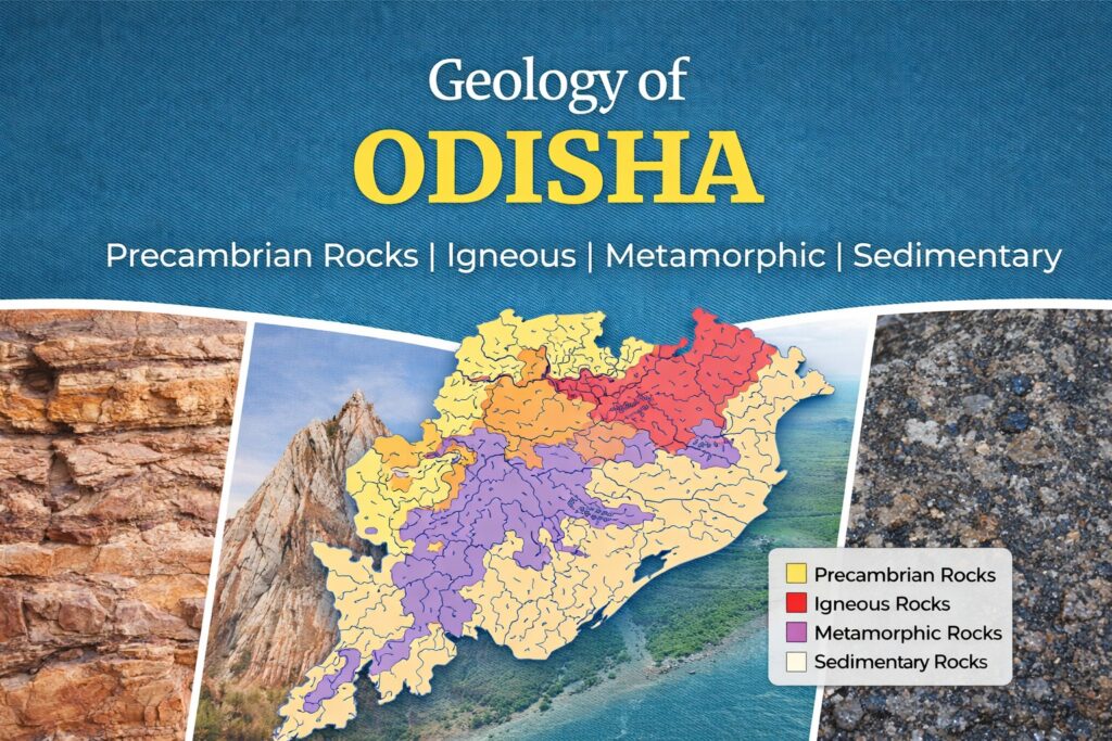
About 72.5% of Odisha is made of ancient Precambrian rocks, more than 540 million years old and in places over 3 billion years old, which host most of its mineral wealth. Gondwana sedimentary rocks, which hold the coal, cover about 8% of the state, and younger Tertiary and Quaternary deposits make up the rest (Directorate of Geology, Odisha).
Odisha lies on the eastern edge of the Indian Shield, the stable old core of peninsular India. Here several ancient crustal blocks meet: the Singhbhum Craton in the north, the Bastar Craton in the west, and the Eastern Ghats Granulite Belt in the south, a mountain belt that once joined India to East Antarctica in the supercontinent of Gondwana. Later, rifts along the Mahanadi valley filled with coal-bearing sediments, and the coastline grew outward with sediments carried by the great rivers.
This geological history explains why Odisha is India’s mineral treasury, why its landscape has plateaus, hill ranges, river valleys and deltas, and why its soils and groundwater vary so much from place to place. This article covers the geological framework, stratigraphic succession, major rock formations, structure and seismicity, the economic importance of geology, and important geoheritage sites.
Table of Contents
Geological framework
Odisha can be divided into a few major geological domains: two ancient cratons, a high-grade mountain belt, a transition zone between them, younger rift basins and the coastal plain.
| Domain | Area covered (approx.) | Main rocks | Significance |
|---|---|---|---|
| Singhbhum (North Odisha) Craton | Keonjhar, Mayurbhanj, Sundargarh, Jajpur, northern Dhenkanal | Old gneisses, Singhbhum and Mayurbhanj granites, Iron Ore Group, ultramafic complexes | One of the oldest pieces of crust in India (over 3 billion years); hosts iron ore, manganese, chromite and nickel |
| Bastar Craton | Western Odisha: Nuapada, parts of Bargarh, Bolangir, Kalahandi and Malkangiri | Granite gneisses and younger Proterozoic sedimentary basins (Khariar, Ampani, Bargarh) | Western ancient block; limestone and other sedimentary minerals |
| Eastern Ghats Granulite Belt | South and west: Koraput, Rayagada, Kalahandi, Kandhamal, Ganjam, Gajapati, Nayagarh, Boudh, Bolangir | Khondalite, charnockite, granite gneiss and anorthosite | A deeply eroded ancient mountain belt; bauxite, graphite, gemstones and manganese |
| Rengali Province (transition zone) | Angul, Deogarh, Sambalpur | Mixed granulites, gneisses and schists | Boundary zone where the Eastern Ghats belt meets the Singhbhum craton |
| Gangpur and other Proterozoic belts | Sundargarh | Schists, phyllites, limestone and dolomite | Limestone, dolomite and manganese for steel and cement |
| Gondwana basins (Mahanadi rift) | Talcher (Angul–Dhenkanal) and Ib Valley (Jharsuguda–Sundargarh) | Sandstone, shale and coal | Odisha’s coalfields |
| Coastal plain and offshore basin | The coastal districts and the Bay of Bengal shelf | Tertiary sediments, laterite and recent alluvium | Fertile deltas, heavy mineral sands and offshore hydrocarbons |
Stratigraphic succession
Odisha’s rocks span more than 3.5 billion years, from some of the oldest rocks on Earth to sediments still being laid down by its rivers. The generalised succession, from youngest to oldest, is:
| Era / age | Approx. age | Rock formations in Odisha | Where found | Minerals |
|---|---|---|---|---|
| Quaternary (Recent and Pleistocene) | Last 2.6 million years | River and delta alluvium, coastal sands, dunes, lagoon (Chilika) deposits | Coastal plains, river valleys | Heavy mineral sands, clay, sand |
| Tertiary | 66–2.6 million years ago | Baripada beds, sediments under the coastal plain and offshore; laterite capping on plateaus | Mayurbhanj (Baripada), coastal belt, plateau tops | Bauxite, laterite, china clay, offshore gas |
| Cretaceous | About 100–66 million years ago | Athgarh Sandstone; volcanic rocks of the Rajmahal type in the subsurface | Athgarh, Cuttack–Khordha area | Building stone |
| Gondwana Supergroup (Permian–Jurassic) | About 300–150 million years ago | Talchir boulder beds (glacial), Karharbari and Barakar coal measures, Kamthi sandstones | Talcher and Ib Valley basins, small outliers | Coal, fireclay |
| Late Proterozoic (Purana) | About 1.6 billion–540 million years ago | Chhattisgarh-type sediments: Khariar, Ampani, Bargarh basins; limestone and shale | Nuapada, Kalahandi, Bargarh | Limestone, dolomite |
| Early to Middle Proterozoic | About 2.5–1.6 billion years ago | Gangpur Group, Singhbhum Group, Eastern Ghats khondalites, charnockites and granites; mafic dykes | Sundargarh, Eastern Ghats region | Manganese, graphite, gemstones, limestone |
| Archaean | Over 2.5 billion years ago | Older Metamorphic Group and tonalite gneisses, Singhbhum and Mayurbhanj granites, Iron Ore Group (banded iron formation), ultramafic complexes of Sukinda and Nuasahi | Keonjhar, Mayurbhanj, Sundargarh, Jajpur | Iron ore, chromite, nickel, manganese, gold |
Ages are approximate, and some formations (for example the Eastern Ghats rocks) went through several episodes of metamorphism at different times.
Precambrian formations: Archaean and Proterozoic
The Precambrian rocks form the plateaus and hill ranges of northern, western and southern Odisha and contain nearly all its metallic minerals.
Singhbhum Craton (North Odisha)
- Older Metamorphic Group and tonalite gneisses: among the oldest rocks in India, over 3.3–3.5 billion years old, exposed around Champua (Keonjhar).
- Singhbhum and Mayurbhanj granites: large granite bodies, about 3.1–3.3 billion years old, forming much of the Keonjhar–Mayurbhanj plateau.
- Iron Ore Group: banded iron formations, shales, volcanic rocks and quartzites folded into the horseshoe-shaped Bonai–Keonjhar synclinorium. Leaching of these rocks over time produced the rich haematite deposits of Joda, Barbil, Koira and Gandhamardan.
- Simlipal Complex (Mayurbhanj): a near-circular basin of volcanic and sedimentary rocks, which forms the Similipal hills.
- Ultramafic complexes of Sukinda (Jajpur) and Baula–Nuasahi (Keonjhar): rocks from deep in the Earth’s mantle that host chromite, nickel and platinum-group elements.
Gangpur Group and other Proterozoic belts
The Gangpur Group of Sundargarh is a folded belt of schists, phyllites, limestone, dolomite and manganese-bearing rocks, about 2.0 billion years old. Its limestone and dolomite supply the cement and steel industries of Rajgangpur, Biramitrapur and Rourkela.
Bastar Craton
Western Odisha is underlain by granites and gneisses of the Bastar Craton. On top lie younger Proterozoic sedimentary basins such as Khariar, Ampani and Bargarh, related to the Chhattisgarh basin, with sandstone, shale and limestone that form flat-topped plateaus like the Khariar plateau.
Eastern Ghats Granulite Belt
The Eastern Ghats are the deeply eroded roots of an ancient mountain range. Their rocks were metamorphosed at very high temperatures and pressures:
- Khondalite (garnet–sillimanite–graphite schists, named after the Khond people of the Khondmals): weathers into thick bauxite and laterite caps on plateaus such as Panchpatmali; also hosts graphite.
- Charnockite: dark, hard rock that forms many hill ranges, including the Mahendragiri and Deomali areas.
- Anorthosite massifs (for example near Chilika and Bolangir), and alkaline rocks such as nepheline syenite in Koraput and Khariar.
The Eastern Ghats belt took its final shape about 1 billion years ago, when the Indian landmass collided with East Antarctica during the formation of the supercontinent Rodinia. Matching rocks are found today in Antarctica.
Rengali Province
Between the Eastern Ghats belt and the Singhbhum Craton lies the Rengali Province (Angul–Deogarh–Sambalpur), a zone of mixed high- and low-grade rocks, bounded by major shear zones. It marks the suture where these two crustal blocks were joined.
Gondwana Supergroup and the Mahanadi rift
About 300 million years ago, when India was part of the southern supercontinent Gondwanaland, the crust along the present Mahanadi valley stretched and sank, forming the Mahanadi Graben, a long rift valley running north-west to south-east. Rivers and swamps filled this rift with sediments, and the thick forests that grew there were buried and turned into coal.
Gondwana succession in Odisha
| Formation | Rock type | Significance |
|---|---|---|
| Talchir Formation | Boulder beds (tillite), shales and sandstones | Deposited by glaciers; named after Talcher, it is the type area for India’s oldest Gondwana rocks |
| Karharbari and Barakar formations | Sandstones, shales and coal seams | Main coal-bearing units of the Talcher and Ib Valley coalfields |
| Barren Measures and Kamthi formations | Sandstones and shales with little coal | Upper Gondwana units forming ridges and plateaus |
| Upper Gondwana (Athgarh Sandstone) | Sandstone | Exposed around Athgarh and Cuttack; used as building stone |
Coal basins
- Talcher Coalfield (Angul and Dhenkanal): one of India’s largest coal reserves, with very thick seams suited to opencast mining.
- Ib Valley Coalfield (Jharsuguda and Sundargarh): extends into Chhattisgarh as part of the larger Mahanadi basin.
Odisha’s Gondwana coal is mostly high-ash, non-coking coal used in thermal power plants, and together these basins hold about a quarter of India’s coal reserves.
The ancient Mahanadi rift still influences the landscape: the Mahanadi and Brahmani rivers follow its trend, and the boundary faults of the graben are among the state’s main structural lines.
Younger formations: Tertiary, laterite and Quaternary
After India broke away from Antarctica about 130 million years ago, Odisha’s eastern edge became a passive continental margin. Its coastal plain and offshore shelf have been building outward ever since, with sediments carried down from the plateaus.
Tertiary formations
- The Baripada beds (Mayurbhanj) are Miocene clays and limestones with marine fossils such as shark teeth and shells, showing that the sea once reached inland.
- Thick Tertiary sediments lie beneath the coastal plain and the Mahanadi offshore basin, where exploration has found natural gas.
Laterite and bauxite
Under a hot, wet tropical climate, long weathering of khondalite, basalt and other rocks leached out silica and left iron- and aluminium-rich crusts. These form:
- Laterite caps on plateaus and uplands around Khordha, Bhubaneswar, Cuttack, Dhenkanal and Keonjhar. Laterite was the main building stone of many historic temples and forts.
- Bauxite caps on the high Eastern Ghats plateaus (Panchpatmali, Baphlimali, Niyamgiri, Gandhamardan), making Odisha India’s leading bauxite state.
Quaternary alluvium and the coast
- Deltas: the Mahanadi, Brahmani–Baitarani, Subarnarekha and Rushikulya rivers have built broad deltas of fertile alluvium. Their old and new channels, levees and backswamps shape the coastal landscape.
- Beach ridges and dunes: a series of old shorelines and sand dunes runs parallel to the coast, especially in Puri, Ganjam and Balasore.
- Chilika Lake: a large brackish lagoon formed over the last few thousand years as a sand barrier (spit) grew across a bay of the sea.
- Heavy mineral sands: the beaches of Ganjam (Chhatrapur), Puri and Kendrapara contain ilmenite, rutile, zircon, monazite, sillimanite and garnet, eroded from Eastern Ghats rocks and sorted by waves.
- Mudflats and mangroves at Bhitarkanika and the river mouths, where fine sediments settle.
Structure, tectonics and seismicity
Odisha lies on a stable part of the Indian Plate, far from the active Himalayan plate boundary, but old faults and shear zones still shape its rivers, hills and occasional earthquakes.
Major structural features
- Mahanadi Graben faults: the north-west–south-east boundary faults of the Gondwana rift, followed by the Mahanadi and Brahmani valleys.
- Shear zones separating the crustal blocks: for example the shear zones bounding the Rengali Province and the Eastern Ghats belt, and the Sukinda thrust zone.
- Folded belts: the Bonai–Keonjhar horseshoe synclinorium of the Iron Ore Group and the folded Gangpur belt in Sundargarh.
- Lineaments and fractures that guide river courses, waterfalls and groundwater flow across the plateaus.
Hot springs
Deep faults let groundwater circulate to warm depths and rise as hot springs, such as Atri (Khordha), Taptapani (Ganjam), Tarabalo (Nayagarh) and Deulajhari (Angul). They are popular pilgrimage and tourist spots and have some geothermal potential.
Seismicity
Most of Odisha falls in Seismic Zone II (low hazard), while parts of the coast and the Mahanadi rift region fall in Zone III (moderate hazard) under the Bureau of Indian Standards’ earthquake zoning. The state has felt only small and moderate earthquakes, mostly along old faults in the rift and the Eastern Ghats margin. Its main natural hazards are cyclones and floods rather than earthquakes, though the coast is exposed to tsunamis from distant earthquakes in the Bay of Bengal, as in 2004.
Geology, landscape and economy
Geology underpins Odisha’s minerals, landforms, soils, groundwater and even its temple architecture.
| Geological unit | Landscape | Minerals | Soils | Groundwater |
|---|---|---|---|---|
| Singhbhum Craton (north) | Plateaus and ridges of Keonjhar, Mayurbhanj, Sundargarh | Iron ore, manganese, chromite, nickel | Red and lateritic | Limited; in weathered zones and fractures |
| Eastern Ghats belt (south-west) | High hills and plateaus, Deomali, Mahendragiri | Bauxite, graphite, gemstones, manganese | Red, laterite and hill soils | Poor; mainly in fractures and valley fills |
| Bastar Craton and Proterozoic basins (west) | Undulating plains and flat plateaus (Khariar) | Limestone, dolomite | Red and mixed red–black | Moderate in limestone; poor elsewhere |
| Gondwana basins (centre-north) | Low ridges and valleys in Talcher and Ib | Coal, fireclay | Red and yellow | Moderate in sandstones |
| Coastal alluvium | Flat deltas, beach ridges, Chilika | Heavy mineral sands, clay | Fertile alluvium; saline near the sea | Rich, but saline near the coast and at depth |
Building stone and heritage
Odisha’s temple builders used local rocks. Khondalite was used for the Sun Temple at Konark and many Bhubaneswar temples, laterite for compound walls, forts and foundations (as at Jagannath temple, Puri), and sandstone from the Athgarh area for many shrines. Today, granite, charnockite and decorative stones from Bolangir, Kalahandi, Keonjhar and Mayurbhanj are quarried as dimension stone.
Hazards linked to geology
- Coastal erosion at places such as Satabhaya and Pentha (Kendrapara) and around Puri and Ganjam.
- Fluoride in groundwater in parts of Nuapada, Bolangir, Bargarh, Angul and Nayagarh, and salinity along the coast.
- Landslides on steep Eastern Ghats slopes during heavy rain, and subsidence and fires in old coal mines.
Geoheritage and notable geological sites
| Site | District | Geological interest |
|---|---|---|
| Pillow lavas of Nomira | Keonjhar | Ancient underwater lava flows of the Iron Ore Group; a Geological Survey of India geo-heritage site |
| Gonasika and Khandadhar | Keonjhar, Sundargarh | Iron-rich hills of the Bonai–Keonjhar belt; Khandadhar falls tumble over banded iron formation |
| Satkosia Gorge | Angul–Boudh | The Mahanadi cuts a deep gorge through the Eastern Ghats rocks |
| Simlipal hills | Mayurbhanj | Circular Simlipal Complex of ancient volcanic and sedimentary rocks |
| Udayagiri–Khandagiri caves | Khordha | Rock-cut caves in sandstone near Bhubaneswar, dating from the 1st–2nd century BCE |
| Deomali and Panchpatmali | Koraput | Highest peak of Odisha and bauxite-capped khondalite plateau |
| Taptapani and Atri | Ganjam, Khordha | Fault-related hot springs |
| Chilika Lake | Puri, Khordha, Ganjam | Lagoon formed behind a growing sand barrier |
| Gahirmatha and Rushikulya coasts | Kendrapara, Ganjam | Active beach and delta processes, heavy mineral sands |
Conclusion
Odisha’s geology tells a story spanning more than 3.5 billion years: ancient continental crust in the north, a mountain belt shared with Antarctica in the south, coal-filled rift valleys in the centre and young deltas on the coast. This long history has given Odisha its plateaus and hills, its fertile deltas and, above all, its exceptional mineral wealth. Understanding it is key to using these resources wisely, managing groundwater and protecting geoheritage sites for the future.
Quick facts for exam aspirants
- About 72.5% of Odisha is covered by Precambrian rocks; Gondwana rocks cover about 8%.
- Oldest rocks: Older Metamorphic Group and gneisses of the Singhbhum Craton (over 3.3 billion years).
- Iron ore occurs in the Iron Ore Group of the Bonai–Keonjhar belt.
- Chromite and nickel occur in the Sukinda and Baula–Nuasahi ultramafic complexes.
- Bauxite forms by laterisation of khondalite on Eastern Ghats plateaus.
- Khondalite is named after the Khond people of the Khondmals (Kandhamal).
- The Talchir Formation (type area: Talcher) contains glacial boulder beds, the oldest Gondwana rocks.
- Coalfields: Talcher and Ib Valley, in the Mahanadi Graben.
- Heavy mineral sands: Chhatrapur (Ganjam).
- Hot springs: Atri, Taptapani, Tarabalo, Deulajhari.
- Seismic zones: mostly Zone II, parts in Zone III.
Sources
- Directorate of Geology, Odisha: Geology and Mineral Resources of Orissa
- Odisha Steel & Mines Department
- Geological Survey of India, publications on the geology and geo-heritage sites of Odisha
© Odisha Geography · Generated on November 8, 2026